Your Cart is Empty


Sold Out
This regional waterproof map of the Top End and Gulf is ideal for discovering the northern parts of Australia's NT by 4WD. It includes a main map of the Darwin region, Judbarra / Gregory National Park, Nhulunbuy, Keep River National Park and Boodjamulla (Lawn Hill) National Park.
There is additional tourist information for Arnhem Land, the Roper River trek, Darwin region, Douglas-Daly district, Nature’s Way, Victoria Highway, Katherine Region and the Stuart Highway Region.
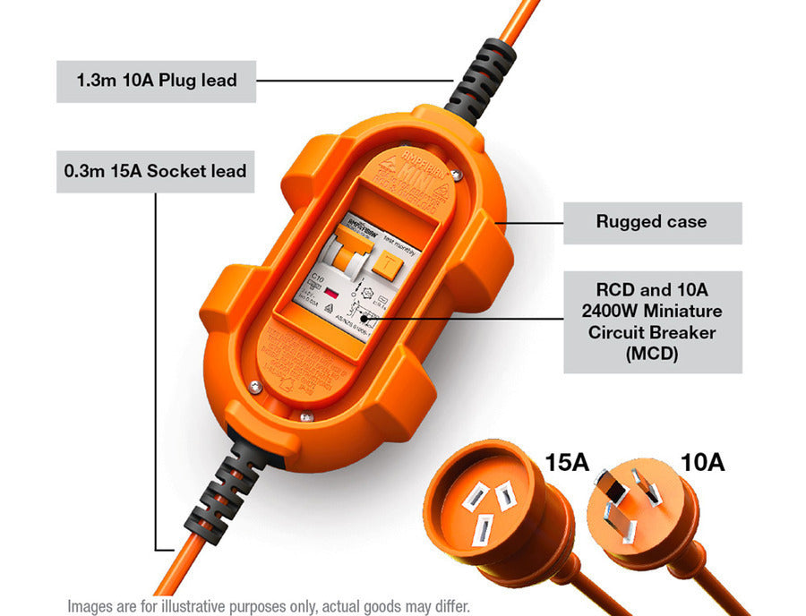
Features